
On this page we provide some physical and thematic maps of Venezuela and selected regions in different resolutions. These maps might be useful for travellers, who want to plan their Venezuela trips individually, or anyone, who is interested to learn more about Venezuela.
")
Venezuela – Topography
Physical map of Venezuela contains rivers, highways, cities and state border of Venezuela.
")
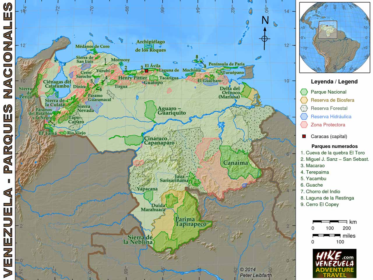
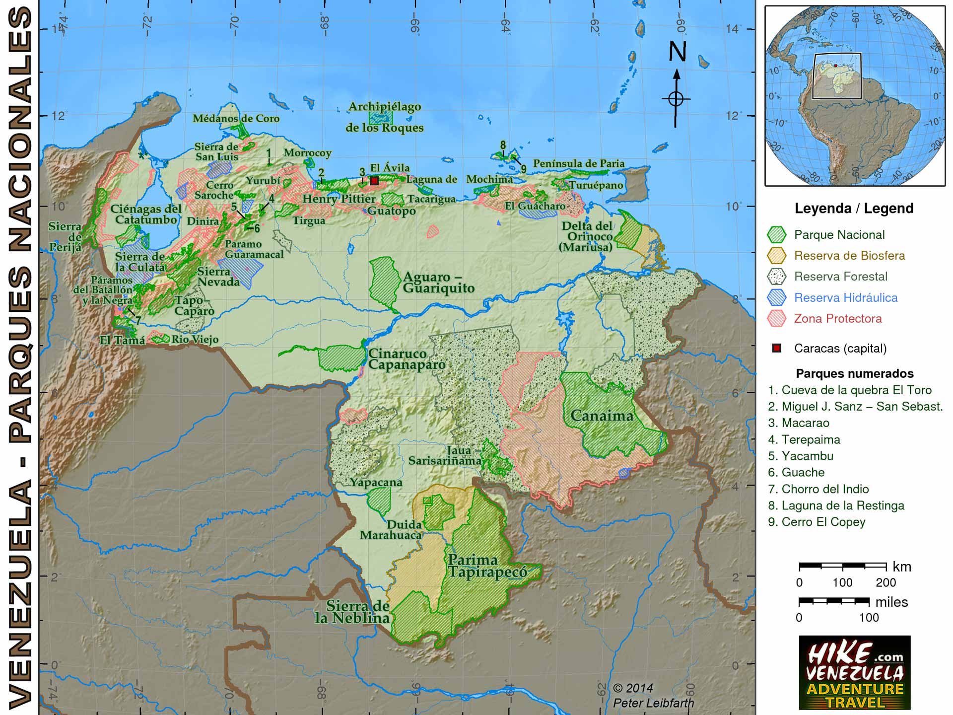
Venezuela – National Parks
Map contains all National Parks of Venezuela, biosphere, forest and water reservations and protected zones. Official data from IGVSB.
")
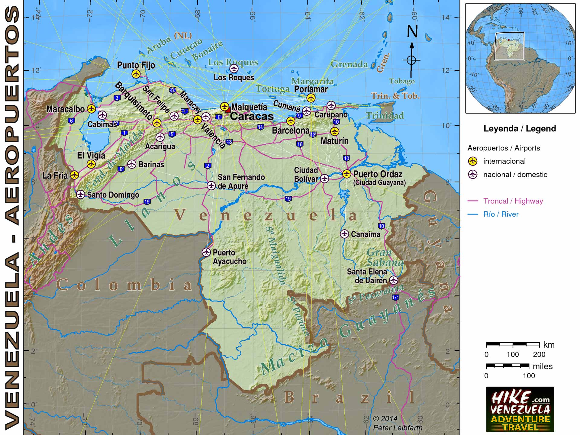
Venezuela – Airports
Map contains all international and major domestic airports of Venezuela as well as all highways (carretera troncal).
")
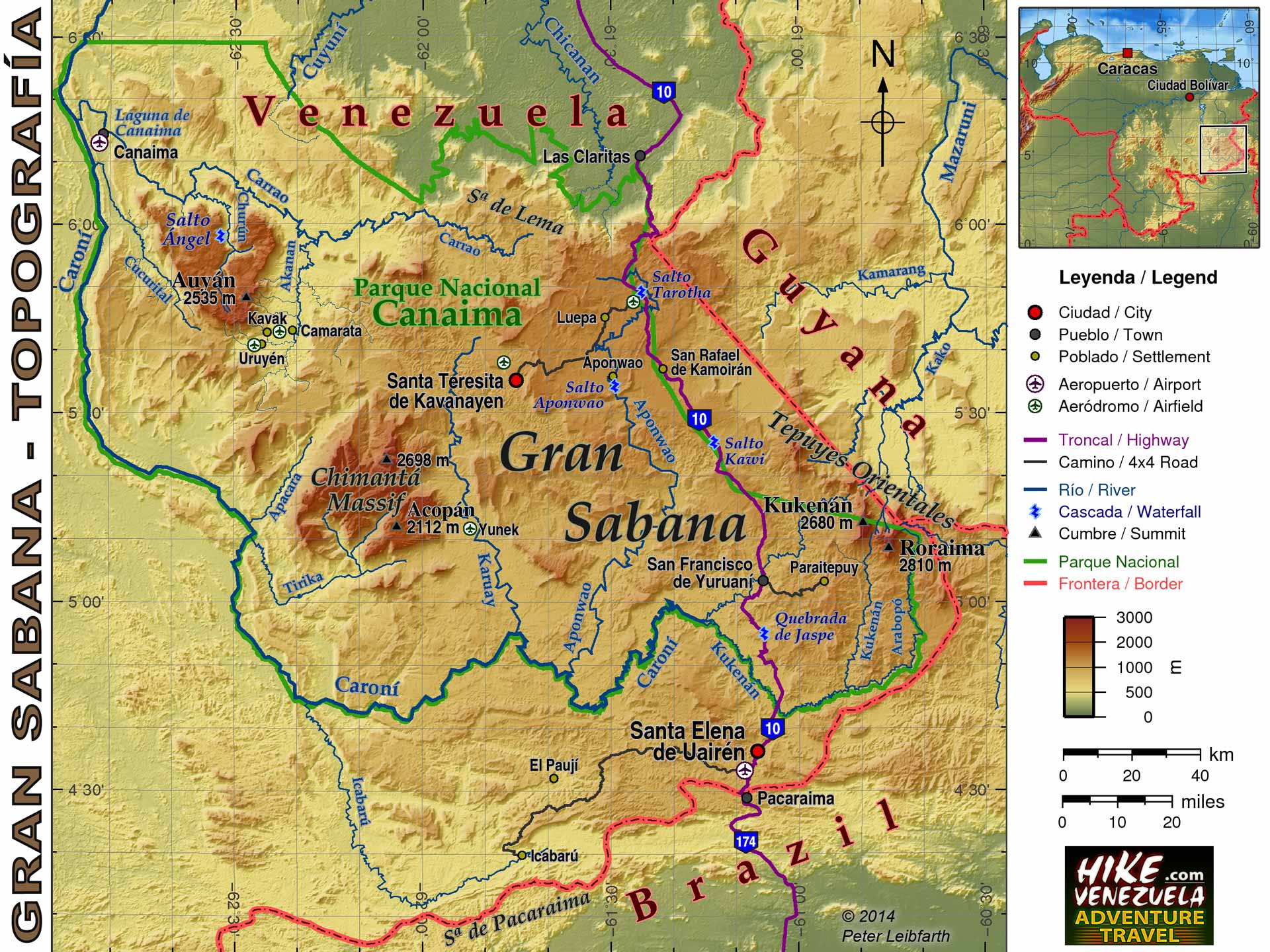
Gran Sabana – Topography
Physical map of Gran Sabana contains rivers, waterfalls, highways, populated places, airports and outline of Canaima National Park.
")
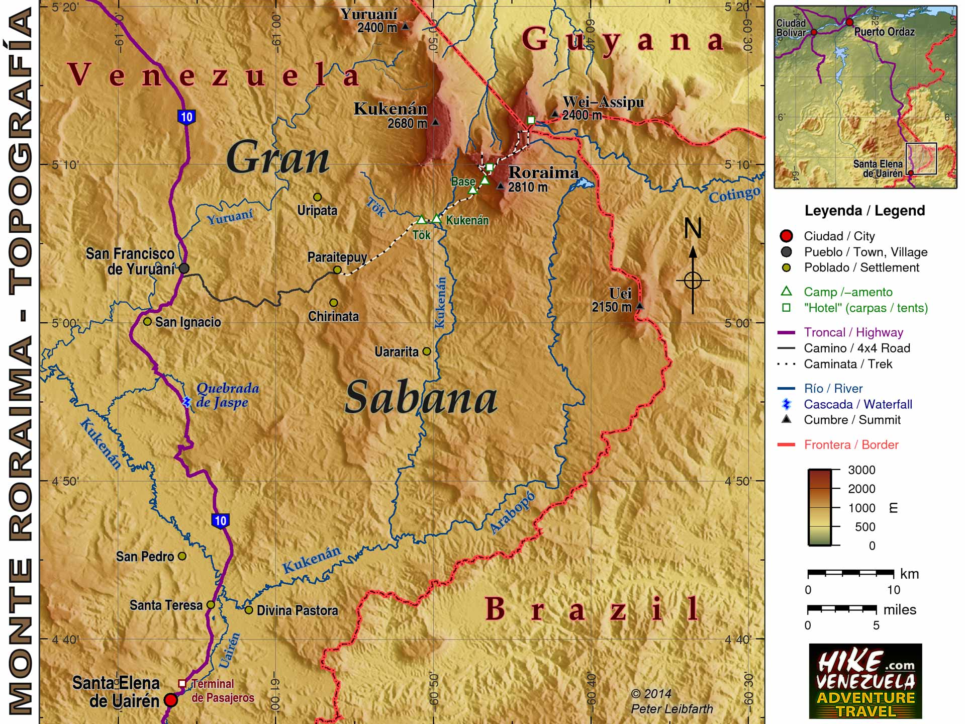
Mount Roraima – Topography
Physical map of Mount Roraima contains rivers, waterfalls, road lines, trek line, populated places (incl. Pemon settlements) and camp sites.
")
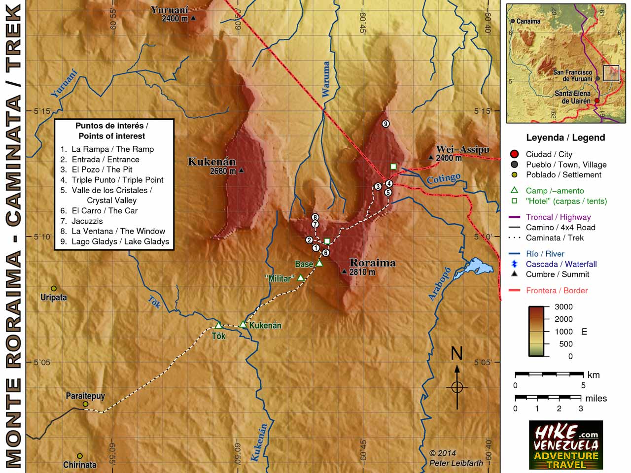
Mount Roraima – Trek
Physical map of Mount Roraima contains rivers, trek line, camp sites and points of interest.
")
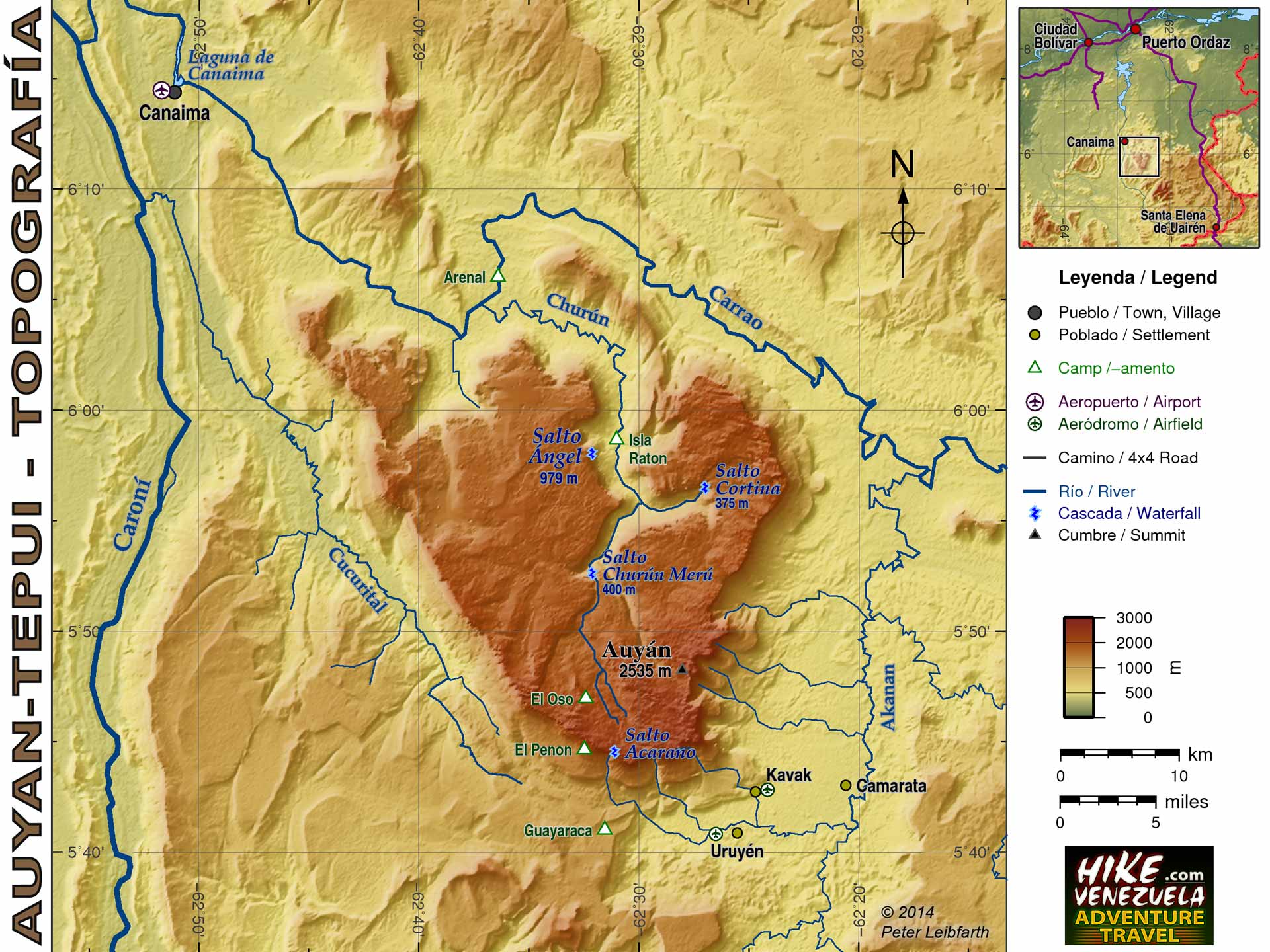
Auyan-tepui – Topography
Physical map of Auyan-tepui contains rivers, waterfalls, Pemon settlements and camp sites.
")
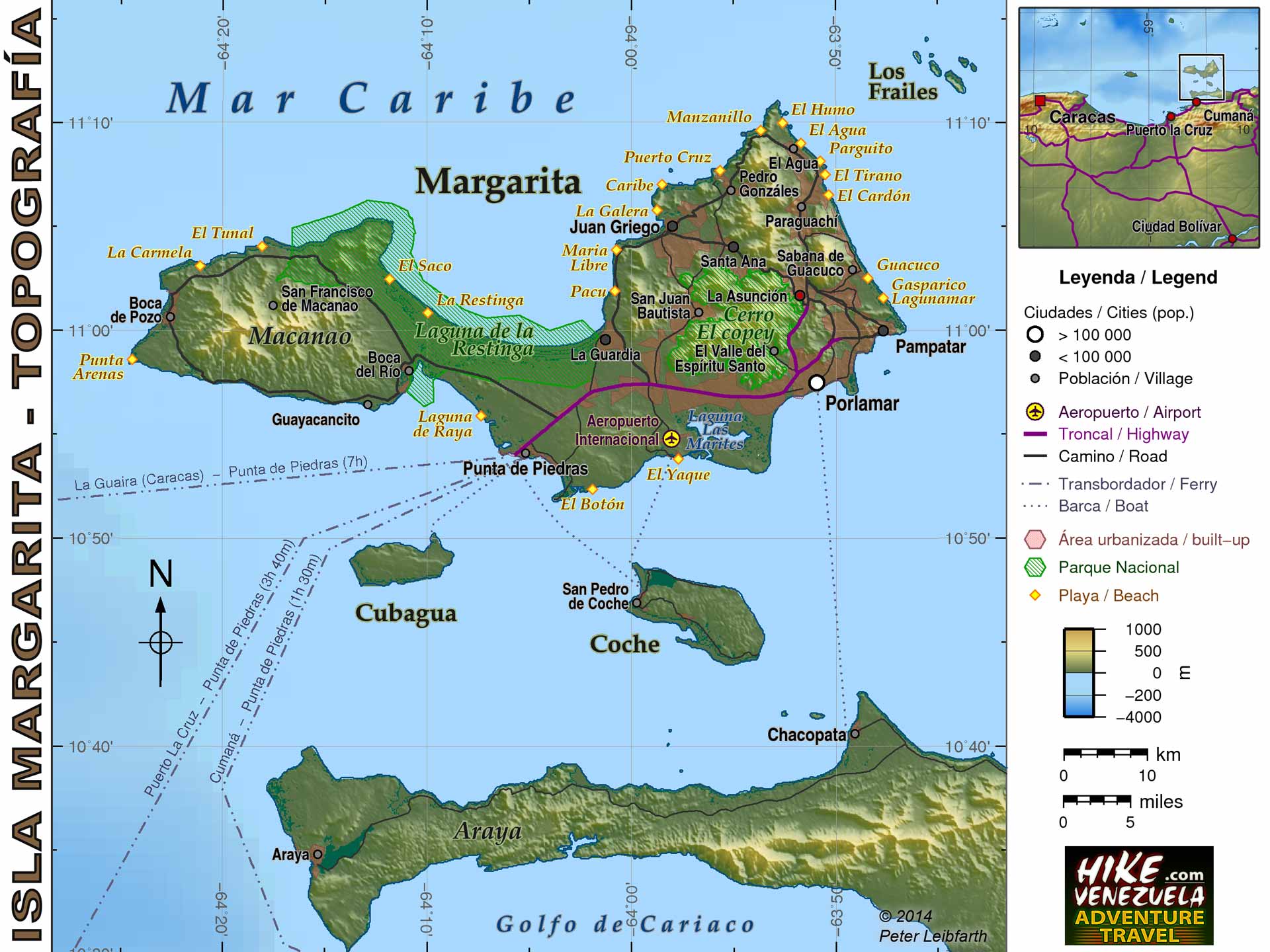
Isla Margarita – Topography
Physical map of Isla Margarita contains road lines, cities, airports, beaches, national parks, urbanization.
